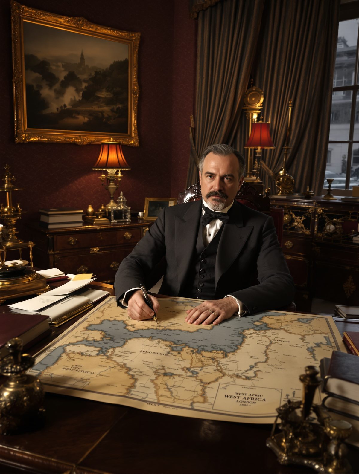
On a sweltering August morning in 1947, Sir Cyril Radcliffe sat in his New Delhi office, sweating through his formal English suit as he stared at a map of India that would soon cease to exist. In his hands lay a fountain pen that would prove mightier than any sword in history—within 36 days, the strokes of his pen would create two nations, displace 14 million people, and trigger one of the largest mass migrations humanity had ever witnessed. The most extraordinary part? He had never set foot in India before accepting this impossible task.
This is the story of how a London barrister who knew more about English tort law than Indian villages became the architect of one of the most consequential borders ever drawn—and why he burned every scrap of his work when it was done.
The Man Who Never Went East
Sir Cyril Radcliffe was the epitome of English respectability: a successful barrister, a director of the Bank of England, and a man who had spent his entire 48 years within the comfortable confines of British society. His expertise lay in commercial law and taxation disputes—hardly the résumé you'd expect for someone tasked with dismantling the crown jewel of the British Empire.
But that was precisely why Lord Mountbatten, the last Viceroy of India, chose him. In June 1947, with independence looming and communal violence already erupting across the subcontinent, Mountbatten needed someone without Indian connections, someone who couldn't be accused of favoritism toward Hindu, Muslim, or Sikh communities. Radcliffe's complete ignorance of Indian affairs wasn't a bug—it was a feature.
When the telegram reached Radcliffe's London chambers, it contained what may have been history's most understated job description: draw the borders between India and Pakistan. The fate of 400 million people hung in the balance, and Britain wanted it done before the monsoon ended.
Thirty-Six Days to Divide a Civilization
Radcliffe arrived in New Delhi on July 8, 1947, stepping off the plane into a furnace of heat, humidity, and barely contained chaos. He had exactly 36 days before independence day—August 15—to complete his task. The Partition Plan called for dividing both Punjab in the west and Bengal in the east, creating borders that would separate Pakistan from what would become India.
The scale was breathtaking: Punjab alone was home to 34 million people spread across 136,000 square miles. Bengal housed another 60 million. Radcliffe had to consider religious demographics, but also rivers, railways, roads, and the economic viability of the resulting territories. Every village, every field, every well had to be assigned to one nation or another.
Working from a requisitioned government building in the scorching Delhi heat, Radcliffe pored over maps so detailed they showed individual villages, many with names he couldn't pronounce. His staff consisted of just two boundary commissions—one for Punjab, one for Bengal—each with four members equally divided between the Indian National Congress and the Muslim League. Predictably, they disagreed on virtually everything.
The pressure was extraordinary. Outside his windows, Delhi seethed with tension as rumors spread about which side of the line various communities would find themselves on. Sikh leaders threatened violence if their holiest sites ended up in Pakistan. Muslim representatives warned of catastrophe if key economic centers were assigned to India. Meanwhile, the clock ticked relentlessly toward August 15.
The Impossible Geometry of Division
What Radcliffe discovered as he studied the maps was that clean partition was geometrically impossible. Centuries of coexistence had created a subcontinent where religions, communities, and economies were thoroughly intermingled. In Punjab, Sikh villages sat surrounded by Muslim ones. In Bengal, Hindu enclaves were scattered throughout Muslim-majority areas like islands in an archipelago.
Take the case of Chittagong, Bengal's second-largest port. The city was 70% Hindu, but the surrounding countryside was overwhelmingly Muslim. Award it to India, and you'd create an impossible exclave. Give it to Pakistan, and you'd hand over a massive Hindu population to the new Muslim state. Either choice would trigger mass displacement.
Or consider the problem of the Radcliffe Line cutting through the middle of villages. In Punjab, his border sliced through Kasur, leaving the railway station on the Pakistani side but the approach roads in India. Families found themselves on opposite sides of an international border, their fields and wells suddenly in different countries.
Perhaps most cruelly, the line cut straight through the middle of some villages entirely. In the village of Wahga (later site of the famous border ceremony), Radcliffe's pen left some houses in India and others in Pakistan, separated by what would become one of the world's most militarized borders.
The Secret Verdict
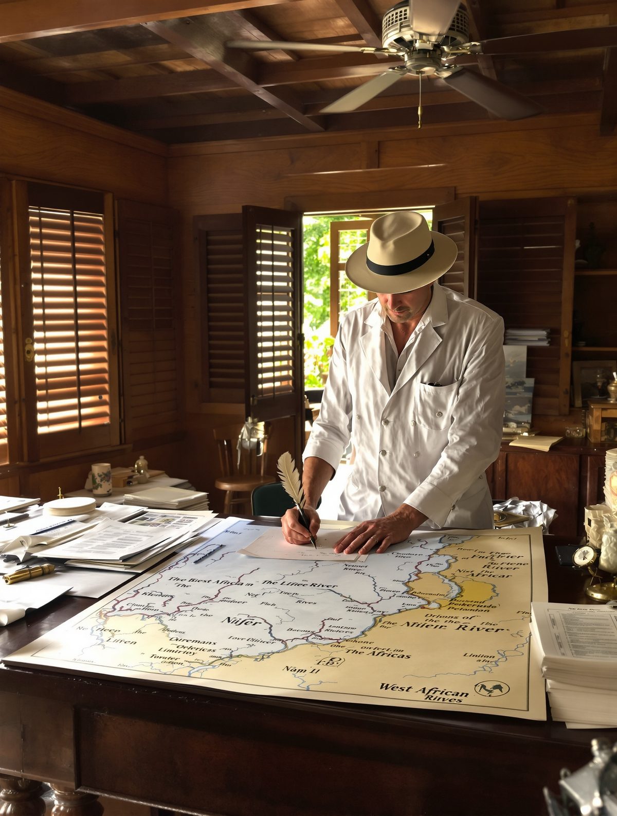
As August 15 approached, Radcliffe worked increasingly alone. The boundary commissions had deadlocked completely, leaving him to make the final decisions solo. He barely ate, rarely slept, and refused all social invitations. His secretary later recalled finding him at his desk at all hours, maps spread around him like a general planning a campaign, except his battlefield was human geography.
In a decision that would prove momentous, Mountbatten chose to keep Radcliffe's award secret until after independence ceremonies concluded. The rationale was preventing last-minute violence that might disrupt the handover of power. But this meant that millions of people celebrated independence without knowing which country they were actually citizens of.
When the Radcliffe Award was finally published on August 17, 1947, the reaction was immediate and devastating. The Sikh community erupted in fury when they discovered that their holiest site, Nankana Sahib (birthplace of Guru Nanak), had been awarded to Pakistan. Muslims in Bengal were equally outraged to find Calcutta assigned to India, despite the city's economic dependence on East Bengal's jute farms.
Most catastrophically, millions of people found themselves on the "wrong" side of the new borders. Hindus and Sikhs in Pakistani territory began a desperate exodus toward India, while Muslims in Indian areas fled toward Pakistan. The resulting mass migration involved 14 million people—one of the largest population movements in human history.
The Burning of the Papers
As communal violence exploded across the newly drawn borders and refugee camps swelled with millions of displaced people, Radcliffe made a remarkable decision. On the eve of his departure from India, he gathered all his working papers—his notes, correspondence, draft maps, and deliberations—and burned them in a bonfire behind his New Delhi office.
His explanation was characteristically understated: he didn't want future historians picking through his reasoning. But friends later suggested a deeper motive. Radcliffe had come to understand the human cost of his lines on the map. Conservative estimates put the death toll from Partition at 200,000; other historians suggest it may have reached one million. Villages that had coexisted for centuries became battlegrounds overnight.
Radcliffe refused his £3,000 fee and departed India on August 15, 1947—independence day itself. He never returned to the subcontinent, and rarely spoke publicly about his experience. When pressed by journalists in later years, he would only say that it had been "an impossible task" and that he'd "done his best in an impossible situation."
Lines That Echo Through Time
Today, nearly eight decades later, the Radcliffe Line remains one of the world's most militarized borders. India and Pakistan have fought four wars, developed nuclear weapons largely with each other in mind, and spent countless billions on defense that might have gone toward development. The Kashmir conflict—partly a product of Radcliffe's hurried deliberations—continues to simmer.
Yet perhaps the most profound legacy isn't geopolitical but human. Partition created the largest refugee crisis in history until that point, and its trauma echoed through generations. Families separated by the border often never reunited. Languages, cultures, and traditions were severed along lines that existed only in Radcliffe's imagination.
The story of Sir Cyril Radcliffe offers a sobering reminder of how arbitrary the forces that shape history can be. A man who had never eaten Indian food or spoken an Indian language drew borders that still define the lives of 1.5 billion people. His 36 days of impossible decisions continue to reverberate through everything from cricket matches to nuclear standoffs.
In our current age of renewed nationalism and border disputes worldwide, Radcliffe's story poses uncomfortable questions about the permanence of the lines we draw on maps—and the very human costs of treating nations like legal briefs to be drafted in distant offices by well-meaning strangers who will never live with the consequences of their pens.